
JACKSONVILLE, Fla. — To become a part of the First Alert Neighborhood weather station network powered by Tempest - scan below &/or click * here *:
Updated every day throughout the hurricane season - “Talking the Tropics With Mike”.
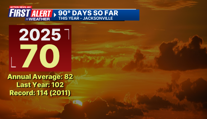
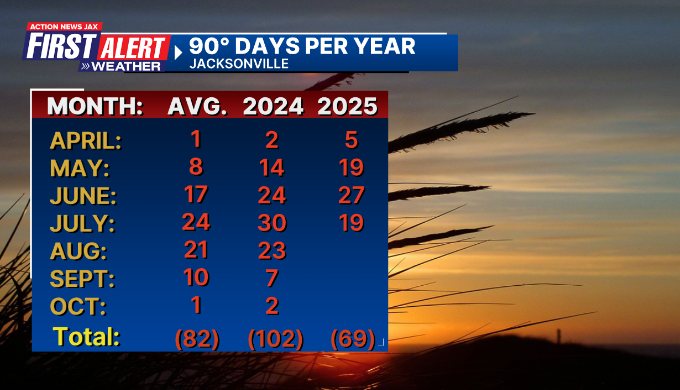
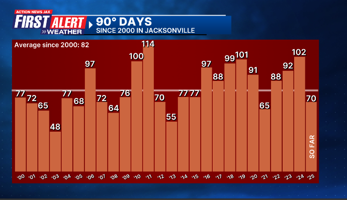
Our summer of discontent is reaching its peak as our (Jacksonville/NE FL./SE Ga.) 90 degree days continue to mount. As of July 22nd, JAX Airport had hit 90 degrees on 70 days - just 12 days from the avg. of 82 days for the entire year. The most 90-degree days in a year in Jax is 114 days in 2011. We may very well make a run at that record this year.
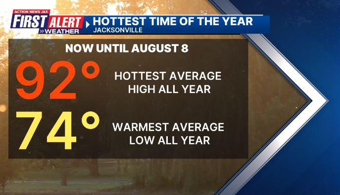
The “dog days” of summer - our hottest high temp. & warmest low temp. of 92 & 74 degrees respectively - continues through August 8th.
Recovery in Texas continues after the horrific July 4th flash flooding as well as another significant - though not as severe - flood the following week. Search & recovery is ongoing but the number of missing has fallen dramatically. The official statewide death toll as of July 22nd is at least 145. The goal now after this disaster is that some very real progress will be made in disseminating and understanding weather warnings. Meteorologist Mike Smith sent me a message suggesting what’s needed is a “National Disaster Review Board”. That’s a really good idea though in this era of “less is more”, I’m not sure such a suggestion will be acted upon. Mike points out in a blog post - * here * - that the warnings from National Weather Office’s can be confusing & - even more importantly - not take seriously by the public. And Mike also discovered that some vendors distributing warnings (whether through t.v., apps social media or online) will not display warnings in their entirety. Again - his column “What the National Weather Service Intends to Send in Flash Flood Warning Situations is Often Not What the Public Receives!” is very worth the read.
AP Photo/Gerald Herbert:


