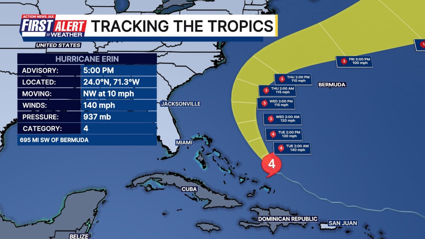
JACKSONVILLE, Fla. — Powerful hurricane Erin is a Category 4 hurricane again north of the Turks and Caicos
Here’s what the First Alert Weather Team said we can expect:
- Powerful hurricane Erin is a Category 4 hurricane again north of the Turks and Caicos
- Fortunately, there is very high confidence in the core of Erin remaining well offshore the eastern United States.
- Erin is growing in size, and is pushing a large swell toward the southeast coast, including all of our beaches.
- Frequent, life-threatening rip currents are very likely at all local beaches today and lasting through at least Thursday.
- Wave heights will build toward 6-10 feet by Wednesday and Thursday. This will cause at least some beach erosion around the times of high tide.
- Higher than normal tides are possible later this week which could produce some minor coastal flooding in the flood-prone tidal locations.
- Behind Erin, another tropical wave bears watching in the long-range but it is far too soon for any specifics.
- The next name is Fernand (pronounced fair-NAHN).
>>> STREAM ACTION NEWS JAX LIVE <<<
[DOWNLOAD: Free Action News Jax app for alerts as news breaks]
[SIGN UP: Action News Jax Daily Headlines Newsletter]
Click here to download the free Action News Jax news and weather apps, click here to download the Action News Jax Now app for your smart TV and click here to stream Action News Jax live.


