JACKSONVILLE, Fla. —
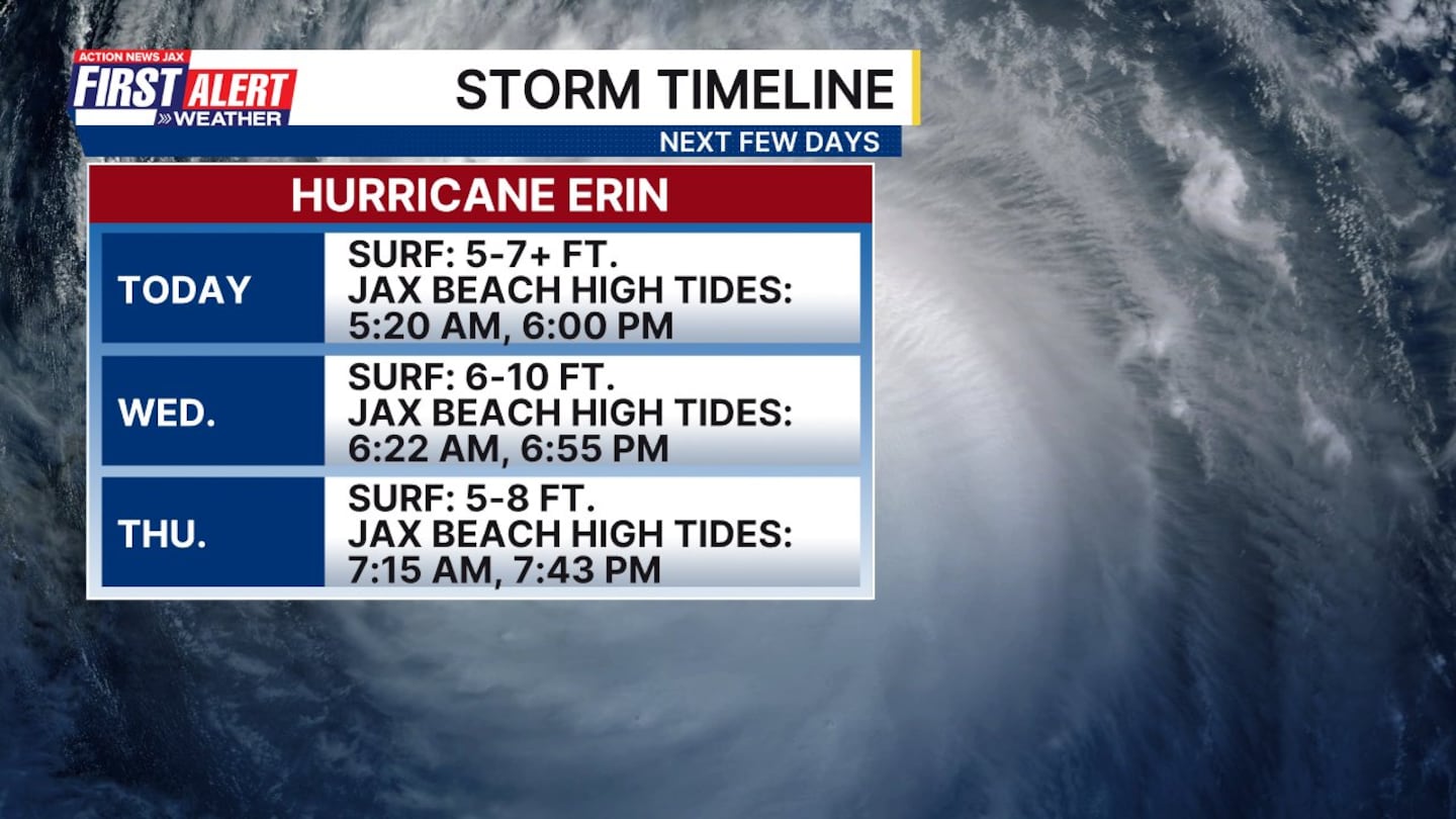
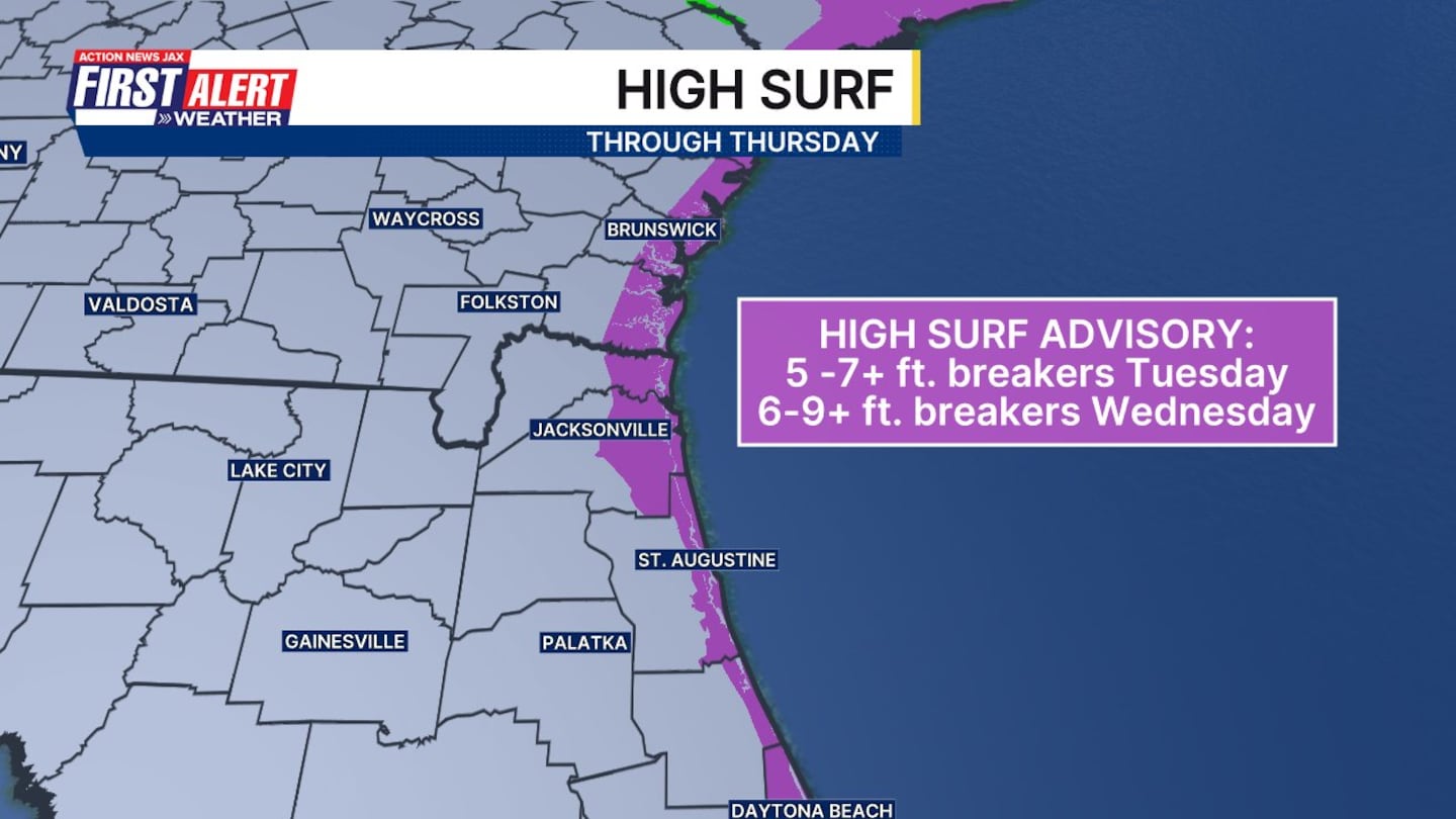
Hurricane Erin remains a major hurricane Tuesday morning east of the Bahamas.
- It will move north over the next few days, continuing to push dangerous swells to the southeast U.S. coastline.
- Locally, minor to moderate beach erosion is possible in some places around the times of high tide.
- Higher than normal tides are expected over the next few days, resulting in some minor coastal flooding in the flood-prone tidal locations.
- Behind Erin, two tropical waves have potential for long-term development, but neither currently pose a threat to land.
- The next two names are Fernand (pronounced fair-NAHN) and Gabrielle.

>>> STREAM ACTION NEWS JAX LIVE <<<
[DOWNLOAD: Free Action News Jax app for alerts as news breaks]
[SIGN UP: Action News Jax Daily Headlines Newsletter]
Click here to download the free Action News Jax news and weather apps, click here to download the Action News Jax Now app for your smart TV and click here to stream Action News Jax live.