JACKSONVILLE, Fla. — Here’s what the First Alert Weather Team said you can expect for the First Alert Weather forecast:
- It’s another beautiful day on Saturday
- JIA dropped to 55 this morning, the coolest morning low since April
- Sunday starts sunny & nice
- There will be more clouds and wind tomorrow, ahead of a cold front
- A few isolated showers will move across the area Sunday afternoon/evening, but it won’t be much rain
- The front moves through and knocks our temps back a bit on Monday
- We gradually warm up again on Tuesday/Wednesday
- Another weak front moves through on Wednesday, dropping our temps once again
- The next best chance for rain after Sunday looks to be next weekend
WATCH THE FORECAST | DOWNLOAD THE APPS
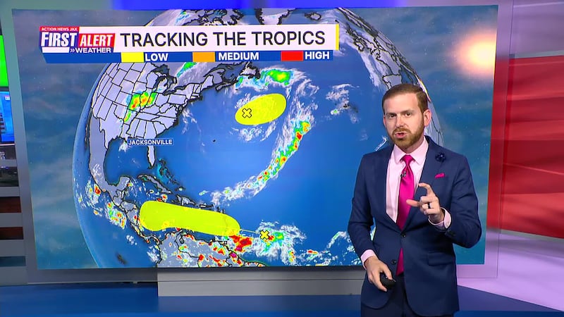
Tropics:
- A big low-pressure area over the North Atlantic may go tropical over the next day or so
- This system is moving away from the U.S. and has a very narrow window it could develop
- A tropical wave is headed into the Caribbean, where there may be some development next week
- Long-range forecasts are starting to show this system lifting into the Atlantic and away from the U.S.
- There’s more agreement or consensus with the forecasts today than there was yesterday & the day before
- But it’s still a long way out; any Caribbean interests next week need to stay up to date with the forecast
- The next named storms will be “Melissa” and “Nestor”
Follow Action News Jax Meteorologists on Twitter for updates:
Mike Buresh | Garrett Bedenbaugh | Corey Simma | Trevor Gibbs
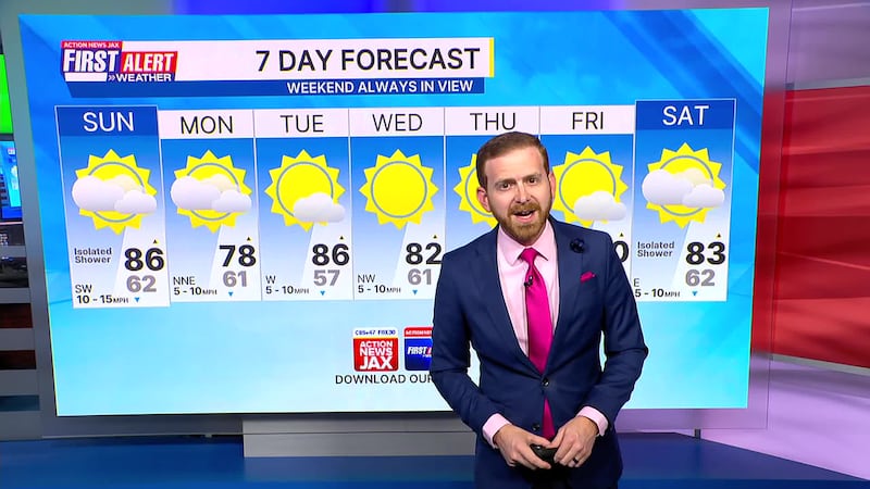
First Alert 7-day Forecast:
- TONIGHT: Mostly Clear & Mild. Low: 62
- TOMORROW: Partly Cloudy, Breezy & Warm. Iso. Evening Showers. High: 86
- MON: Partly to Mostly Sunny. 61/78
- TUE: Mostly Sunny & Warmer. 57/86
- WED: Sunny. 61/82
- THU: Sunny. 55/79
- FRI: Mostly Sunny. 59/80
- SAT: Partly Cloudy, Isolated Shower. 62/83