JACKSONVILLE, Fla. — Here’s what the First Alert Weather Team said you can expect for the First Alert Weather forecast:
- The sea breeze has moved inland this afternoon, and there have been a few storms
- The heaviest rain has been in St. Johns County
- Some neighborhoods have received more than an inch of rain
- Rain amounts are much less closer to I-10, and SE GA has been dry
- There may be a few isolated showers/storms through sunset farther inland
- We’ll be dry area-wide overnight
- There will be storms each day this week
- Coverage starts pretty isolated on Monday, then increases a bit the rest of the week
- There isn’t one day sticking out to me as super wet & stormy
- But there will be locally heavy rain & some spots will get 1″ (+) of rain this week
- Temps stay plenty hot in the low to mid 90s,
WATCH THE FORECAST | DOWNLOAD THE APPS
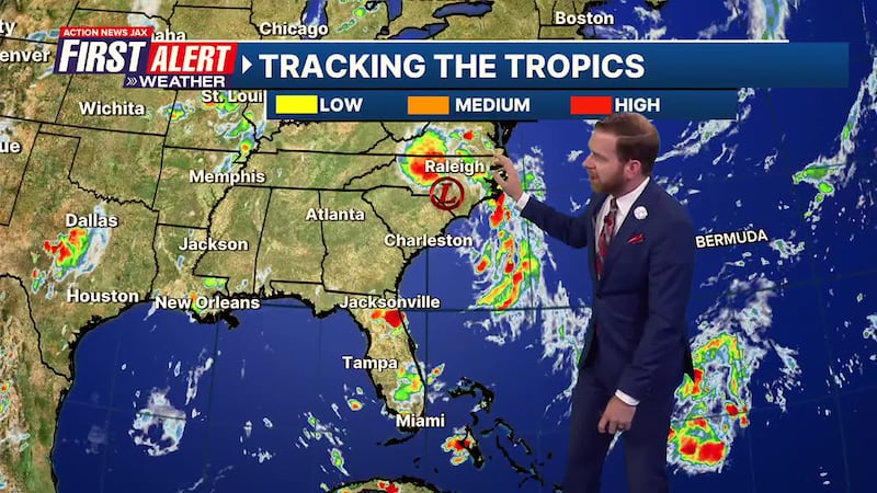
TROPICS
- Chantal made landfall along the South Carolina coast Sunday morning
- It’s moving inland through Eastern North Carolina this evening as a depression
- Chantal should be completely gone tonight/tomorrow
- There aren’t any other active storms or areas of concern
Follow Action News Jax Meteorologists on Twitter for updates:
Mike Buresh | Garrett Bedenbaugh | Corey Simma | Trevor Gibbs
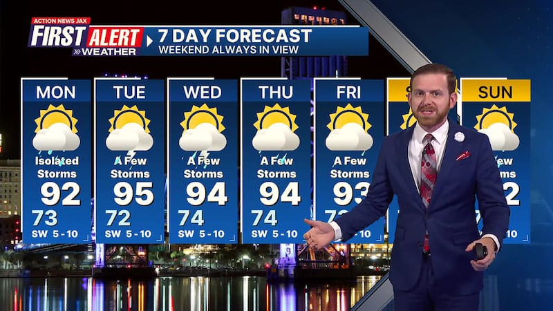
Take a look at the First Alert Weather 7-day forecast:
- TONIGHT: Shower Early, Partly Cloudy. Low: 73
- TOMORROW: Partly Sunny, Isolated Storms. High: 92
- TUE: Partly Cloudy, A Few Storms. 72/95
- WED: Partly Sunny, A Few Storms. 74/94
- THU: Same. 74/94
- FRI: Again. 73/93
- SAT: And again. 74/93
- SUN: One more time. 73/92
LISTEN: Mike Buresh ‘All the Weather, All the Time’ Podcast
SHARE WITH US: Send us photos of the weather you’re seeing in your area ⬇️