JACKSONVILLE, Fla. — Here’s what the First Alert Weather Team said you can expect for the First Alert Weather forecast:
- A few showers & storms are tracking across the area this afternoon
- The heaviest rain has been near & north of I-10, with more isolated coverage farther south
- A few showers & storms may linger past sunset tonight, mainly in SE GA
- Monday brings a very similar setup with the best chance for storms north of I-10
- We can’t rule out spotty storms in NE FL, but coverage will be more isolated
- The sea breeze becomes much more active Tuesday through Thursday
- Rain looks more widespread these days, especially near I-95 & the beaches
- Winds take a turn more southerly & southeasterly Friday through the weekend
- This means the sea breezes will move farther inland & past I-95, enhancing storm coverage west of Jax
- Temps remain in the upper 80s & low 90s each day with plenty of humidity
WATCH THE FORECAST | DOWNLOAD THE APPS
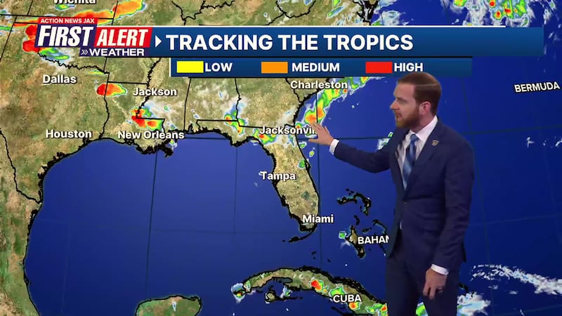
TROPICS:
- There are no active storms and no development expected the next 5-7 days
Follow Action News Jax Meteorologists on Twitter for updates:
Mike Buresh | Garrett Bedenbaugh | Corey Simma | Trevor Gibbs
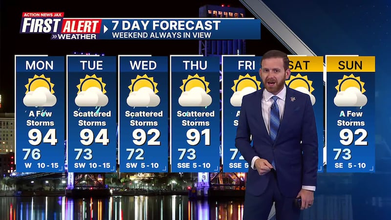
First Alert 7-Day Forecast:
TONIGHT: Mild & Humid. Isolated Shower/Storm North. Low: 76
TOMORROW: Partly Sunny & Hot, A Few Storms. High: 94
TUE: Partly Cloudy, Scattered Storms. 73/94
WED: Partly Sunny, Scattered Storms. 72/92
THU: Partly Cloudy, Scattered Storms. 73/91
FRI: Partly Sunny, A Few Storms. 72/91
SAT: Partly Cloudy, A Few Storms. 73/91
SUN: Partly Sunny, A Few Storms. 73/92
INTERACTIVE RADAR: Keep track of the rain as it moves through your neighborhood
SHARE WITH US: Send us photos of the weather you’re seeing in your area ⬇️


