JACKSONVILLE, Fla. — Here’s what the First Alert Weather Team said you can expect for the First Alert Weather forecast:
- Sunday was another hot and largely dry day
- Jax hit 89, missing 90 by just a degree
- There have been isolated showers streaming onshore in St. Johns County but that’s it in terms of rain
- There may be an isolated shower near the coast in the morning
- The commute will be largely dry
- Monday will bring some inland-moving showers through the day
- Rain coverage does not look widespread
- Temperatures take over this week as we warm into the 90s for a few days
- The days look dry Tue-Thu before a front approaches next weekend
WATCH THE FORECAST | DOWNLOAD THE APPS
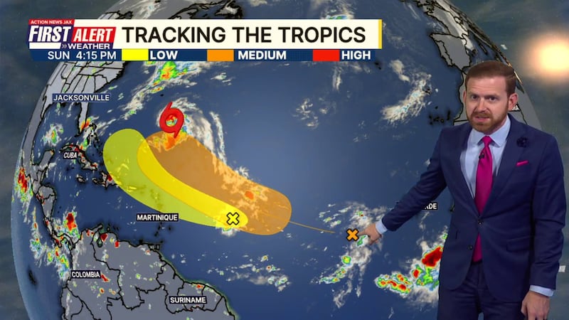
Tropics:
- Gabrielle is now a hurricane, staying away from any land
- Two other areas in the Central Atlantic bear watching in the long term
- Long-range forecasts keep these areas away from the U.S.
- We’ll track them - the next named storm is “Humberto”
Follow Action News Jax Meteorologists on Twitter for updates:
Mike Buresh | Garrett Bedenbaugh | Corey Simma | Trevor Gibbs
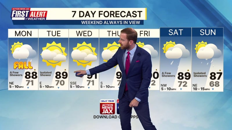
First Alert 7-day Forecast:
- TONIGHT: Partly Cloudy, Iso. Coastal Shower. Low: 71
- TOMORROW: Partly Cloudy & Very Warm, A Few Showers shifting inland. High: 88
- TUE: Partly to Mostly Sunny & Hot, Isolated Shower. 70/89
- WED: Partly to Mostly Sunny. 71/91
- THU: Partly to Mostly Sunny. 71/93
- FRI: Partly Cloudy, A Few Storms. 72/90
- SAT: Partly Cloudy, A Few Storms. 72/89
- SUN: Partly Cloudy, Isolated Shower. 68/87