JACKSONVILLE, Fla. — Here’s what the First Alert Weather Team said you can expect for the First Alert Weather forecast:
- It’s been a stormy day for some local neighborhoods
- Today is the sixth day of rain in a row for some
- Spots in Camden, Glynn, Clay & St. Johns Counties have received more than an inch of rain
- Storms will focus in SE GA & Inland NE FL late evening through about sunset
- It’s a rinse-and-repeat on Sunday
- Showers will first develop around 12-1 PM and grow upscale through the afternoon
- Hwy 301 to the beaches will be the main area to watch for rain, thunder & lightning
- Rain coverage drops a tad on Monday
- Tuesday thru Thursday look largely dry, with temperatures heating up even more
WATCH THE FORECAST | DOWNLOAD THE APPS
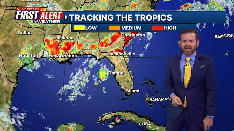
TROPICS:
- No areas of concern
Follow Action News Jax Meteorologists on Twitter for updates:
Mike Buresh | Garrett Bedenbaugh | Corey Simma | Trevor Gibbs
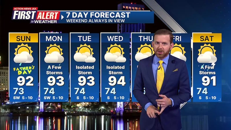
First Alert 7-Day Forecast:
- TONIGHT: Isolated Shower/Storm Early, Partly Cloudy. Low: 73
- TOMORROW: Partly Cloudy, Scattered Showers & Storms. High: 92
- MON: Partly Cloudy, A Few Storms. 74/93
- TUE: Partly Sunny, Isolated Storm. 74/93
- WED: Partly Sunny, Isolated Storm. 74/94
- THU: Partly Sunny, Isolated Storm. 75/95
- FRI: Partly Cloudy, A Few Storms. 75/95
- SAT: Partly Cloudy, A Few Storms. 74/93
SHARE WITH US: Send us photos of the weather you’re seeing in your area ⬇️


