JACKSONVILLE, Fla. — Today will be hot with highs in the 90s across our entire area.
- The morning hours will be mainly dry with isolated afternoon thunderstorms moving southwest to northeast across north Florida this afternoon.
- Storms will be capable of very heavy rain and lightning.
- Moderate risk of rip currents at the beaches today.
- Heat continues this week with highs each day well into the 90s and a daily chance for some afternoon thunderstorms.
- Feels like temperatures will be 100+.
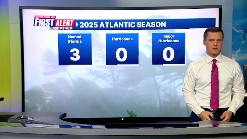
TROPICS:
- Tropical depression Chantal is bringing heavy rain into Virginia this morning. The hurricane center has issued their last advisory for Chantal.
- Elsewhere, there are no areas of concern in the tropics. The next name is Dexter.
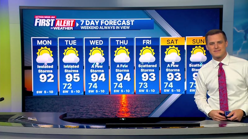
TODAY: Partly cloudy and hot with isolated storms. HIGH: 92
TONIGHT: Partly cloudy. LOW: 72
TUESDAY: Partly cloudy and hot with isolated afternoon storms. 72/95
WEDNESDAY: Partly cloudy with a few afternoon storms. 74/94
THURSDAY: Partly cloudy with a few afternoon storms. 74/94
FRIDAY: Partly cloudy with scattered afternoon storms. 73/93
SATURDAY: Partly cloudy with a few storms. 74/93
SUNDAY: Partly cloudy, scattered afternoon storms. 73/92
>>> STREAM ACTION NEWS JAX LIVE <<<
[DOWNLOAD: Free Action News Jax app for alerts as news breaks]
[SIGN UP: Action News Jax Daily Headlines Newsletter]
Click here to download the free Action News Jax news and weather apps, click here to download the Action News Jax Now app for your smart TV and click here to stream Action News Jax live.