JACKSONVILLE, Fla. — Dry and muggy morning commute.
- Highs today in the upper 90s again.
- Oppressive heat: Feels like temperatures will be 106-109 this afternoon.
- A heat advisory will take effect for all of NE Florida and SE Georgia at 11 a.m. to 7 p.m.
- Only an isolated late afternoon shower or storm will begin to develop after 3 p.m. - 4 pm.
- Locally heavy rainfall and lightning strikes are possible.
- Highs tomorrow will still be hot in the upper 90s.
- This weekend presents a decent shot at more widespread rain and storms.
- Highs stay in the mid to upper 90s through the first half of the weekend.
- We will only be in the mid to upper 80s on Sunday (!)
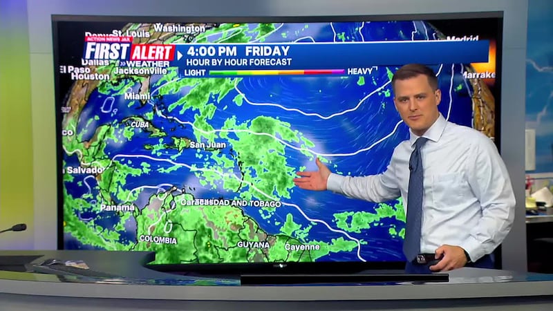
TROPICS:
- No areas of immediate concern… some long-range potential late next week & the following week over or near the Caribbean, Gulf &/or SW Atlantic.
- Always more: “Talking the Tropics With Mike”.
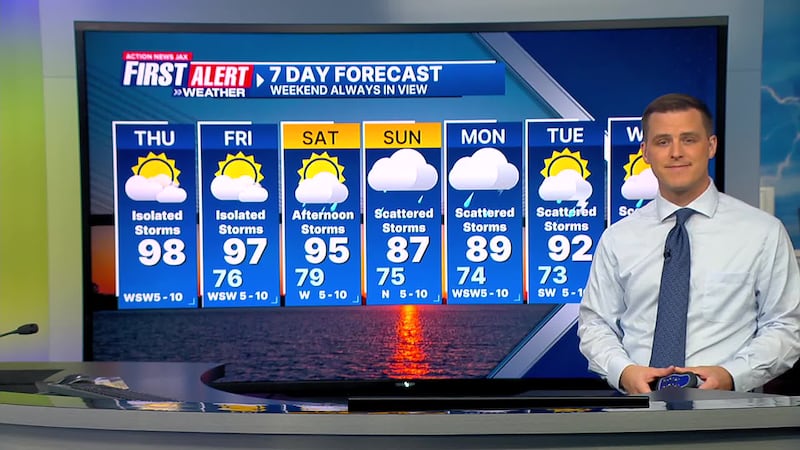
TODAY: Partly sunny and hot with an isolated afternoon storm. HIGH: 98. Feels like: 106-109
TONIGHT: Warm. LOW: 76
FRIDAY: Partly sunny, isolated storms. 76/97
SATURDAY: Partly sunny, scattered afternoon showers and storms. 76/95
SUNDAY: Mostly cloudy, scattered showers and storms. 75/87
MONDAY: Mostly cloudy, scattered afternoon showers and storms. 74/89
TUESDAY: Partly cloudy, scattered showers and storms. 73/92
WEDNESDAY: Partly cloudy, scattered showers and storms. 74/91
>>> STREAM ACTION NEWS JAX LIVE <<<
[DOWNLOAD: Free Action News Jax app for alerts as news breaks]
[SIGN UP: Action News Jax Daily Headlines Newsletter]
Click here to download the free Action News Jax news and weather apps, click here to download the Action News Jax Now app for your smart TV and click here to stream Action News Jax live.


