
JACKSONVILLE, Fla. — The Action News Jax First Alert Weather Team has declared a First Alert Weather Day on Saturday and Sunday due to a local nor’easter in our area.
- A “local nor’easter” will continue now all the way through the weekend.
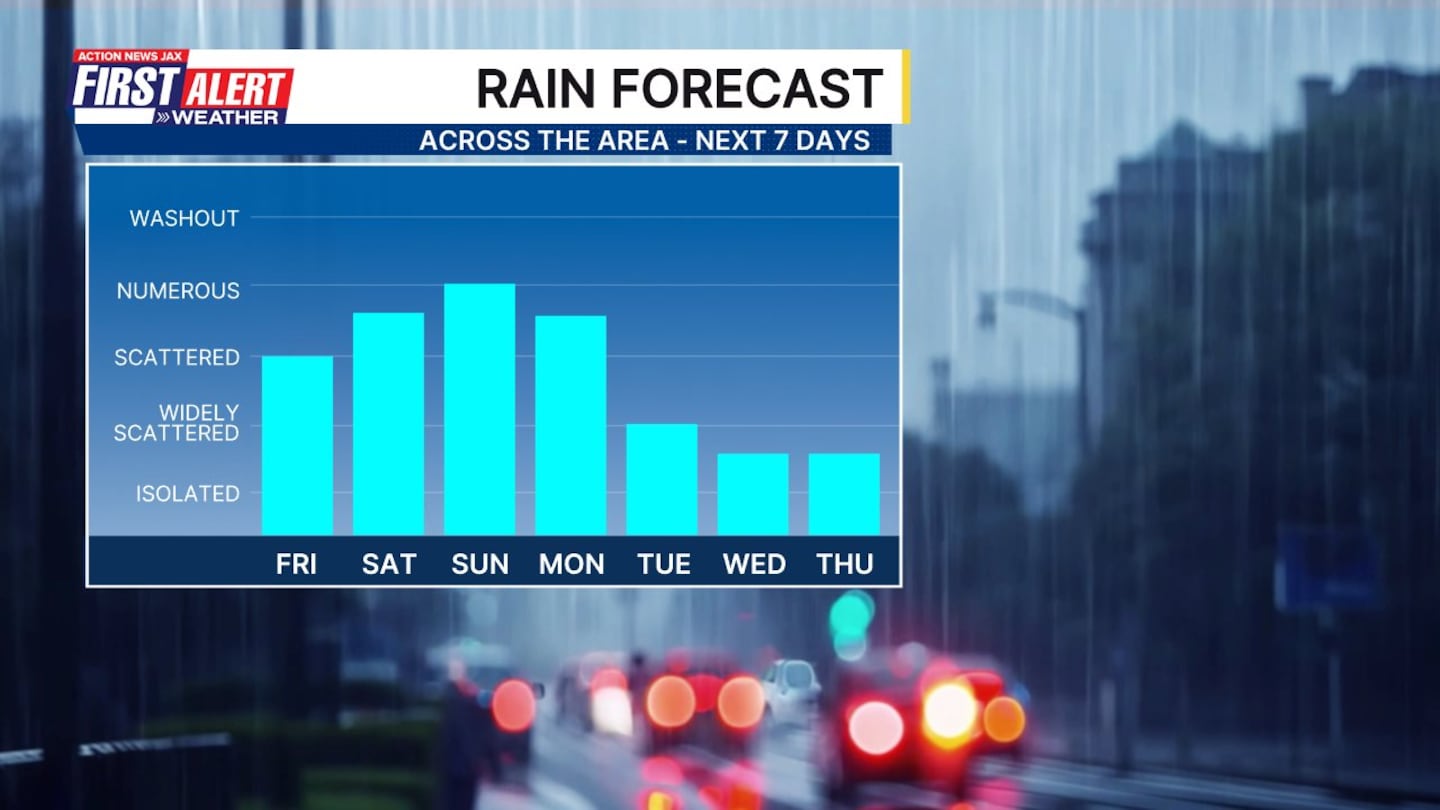
- Scattered showers rolling off the Atlantic this weekend.
- It won’t rain all day, but pockets of impactful downpours.
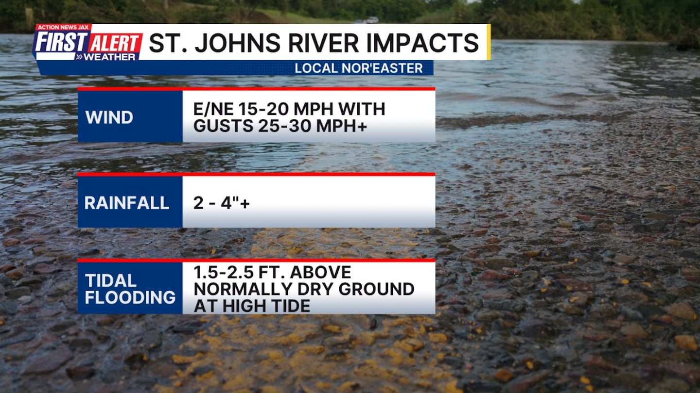
- East winds today at 15-20 mph with higher gusts closer to the coast.
- Scattered showers continue through the day today.
- Keep the umbrellas handy!
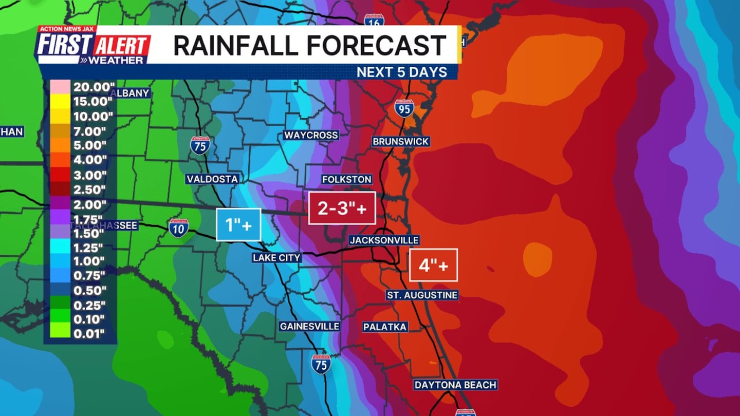
- Rainfall through early next week: Expect bands of heavy rain at times + gusty winds. Rain will be heaviest closer to the coast with as much as 2-4”, locally 5”+ from I-95 to the beaches… 2-3” Highway 301 to I-95… & generally an inch or less, locally 1-2” west of Highway 301.
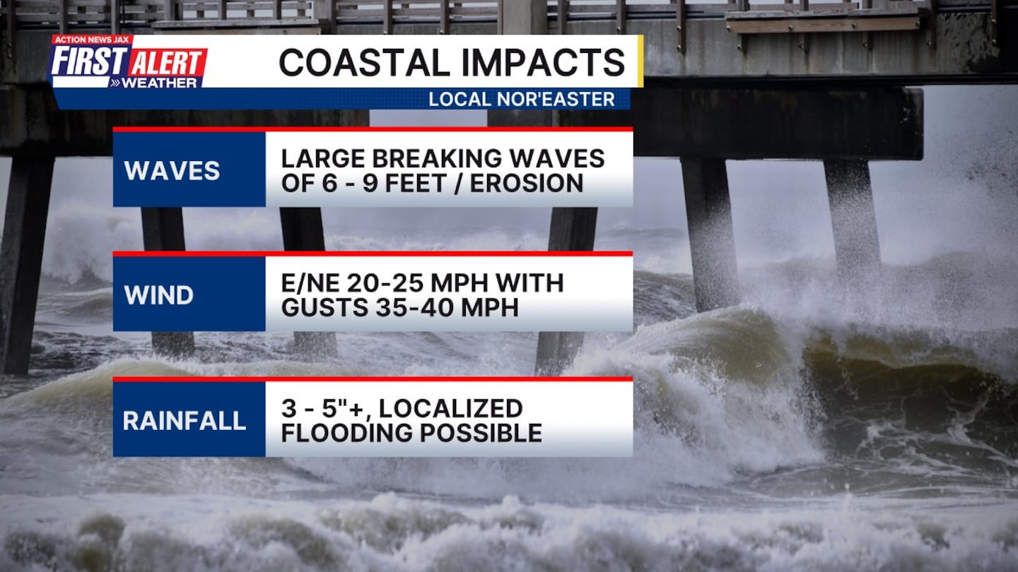
- Poor beach conditions with wind gusts of 30+ mph, rough seas & surf, a high rip current risk + some beach erosion.
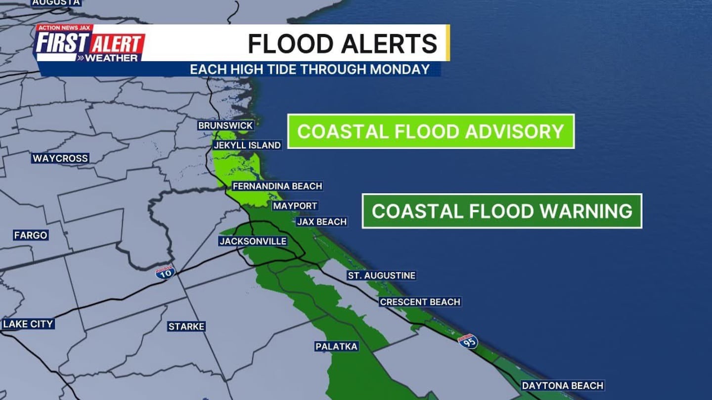
- Some minor to moderate flooding will occur at times of high tide for the beaches, intracoastal, St. Johns River & its tributaries. (2.0 -2.5 ft+)
Temperatures will remain mild but with high humidity. Highs will be in the low 80s with lows in the low 70s.
WATCH THE FORECAST | DOWNLOAD THE APPS
Follow Action News Jax Meteorologists on Twitter for updates:
Mike Buresh | Garrett Bedenbaugh | Corey Simma | Trevor Gibbs
ALLERGY TRACKER: See what the pollen counts look like in our area
LISTEN: Mike Buresh ‘All the Weather, All the Time’ Podcast
INTERACTIVE RADAR: Keep track of the rain as it moves through your neighborhood
SHARE WITH US: Send us photos of the weather you’re seeing in your area ⬇️


