JACKSONVILLE, Fla. — 5 p.m. Update: Erin is now organizing and strengthening over the Central Atlantic. Erin is expected to become at least a Catgory 3 hurricane but missing Puerto Rico to the north and staying well east of Florida. It is expected to reach Jacksonville’s latitude about early Wednesday, resulting in some rough seas and surf at area beaches next week.
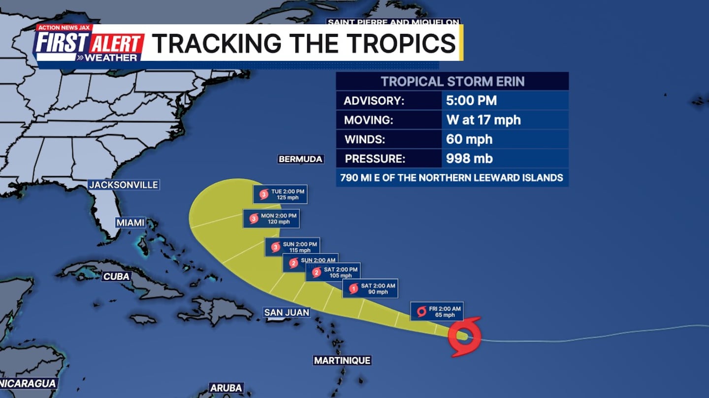
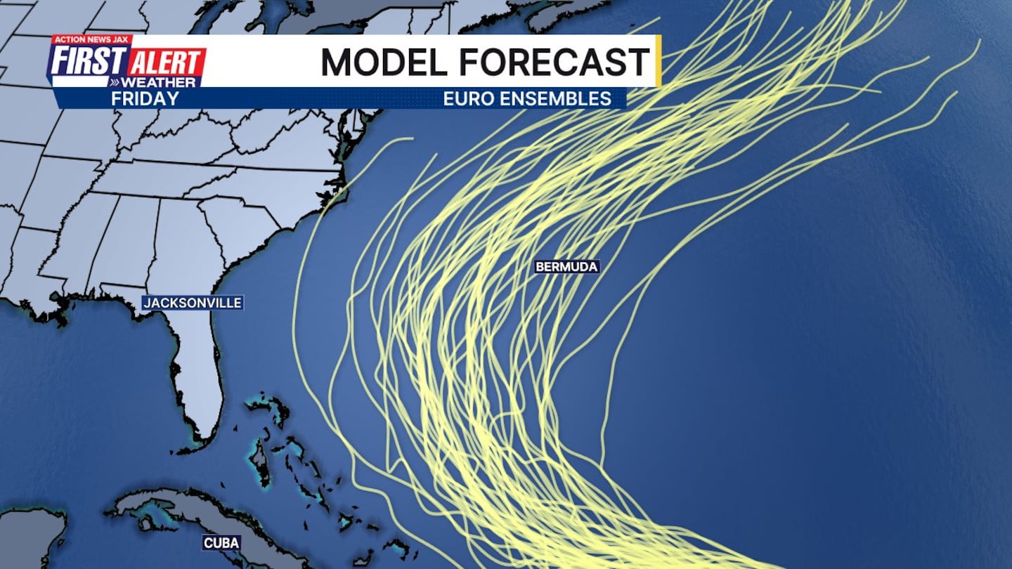
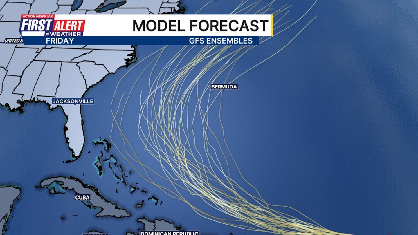
11 a.m. Update: Tropical Storm Erin will be a hurricane soon. A long-term track in between the Bahamas and Bermuda remains favored, with greater uncertainty on just how close the storm eventually gets to the mid-Atlantic states.
Dangerous swells/rip currents will reach our coast early next week.
Erin is weak over the Central Atlantic but is expected to continue strengthening while moving west then turning more north/northwest.
Erin should move north of Puerto Rico over the weekend then turn more north to the east of Florida next week.
The long-range forecast remains especially subject to at least some change.
- Always more: “Talking the Tropics With Mike.”
>>> STREAM ACTION NEWS JAX LIVE <<<
[DOWNLOAD: Free Action News Jax app for alerts as news breaks]
[SIGN UP: Action News Jax Daily Headlines Newsletter]
Click here to download the free Action News Jax news and weather apps, click here to download the Action News Jax Now app for your smart TV and click here to stream Action News Jax live.