JACKSONVILLE, Fla. — Here’s what the First Alert Weather Team said you can expect for the First Alert Weather forecast:
- We are dry across the area with temperatures in the low 90s. The remainder of the evening will be dry and warm with mostly clear skies overnight.
- The big weather story for the eastern half of the country will be a strong, high-pressure ridge settling over the area that will bring temperatures to the mid-90s for our area (Fun fact- we are near the daily record for highest pressure today).
- There are extreme heat warnings scattered from Minnesota to Massachusetts.
- High pressure also keeps us dry, and we will have a continued break from the afternoon storms until the end of the week/into next weekend.
- We will be in the mid-90s starting Tuesday and in the upper 90s for some neighborhoods Wednesday and Thursday.
- Thanks to the sea breeze, the beaches will stay in the upper 80s.
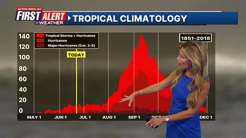
TROPICS:
There’s one area out in the Atlantic with a low chance of development in the next seven days. It will stay out to see. On average, the first named storm in the Atlantic is June 20th.
WATCH THE FORECAST | DOWNLOAD THE APPS
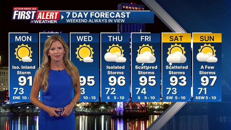
First Alert Weather 7-day forecast:
- TONIGHT: Mostly clear. LOW: 73
- MON: Mostly sunny. Only a few inland showers. 73/91
- TUE: Mostly sunny and hot. 72/95
- WED: Mostly sunny. 73/95
- THU: Partly cloudy with an isolated afternoon storm. 72/96
- FRI: Partly cloudy. Scattered afternoon storms. 74/95
- SAT: Mostly cloudy. Scattered afternoon storms 72/93
- SUN: Partly cloudy. Isolated afternoon storms. 71/97
high-pressure
Follow Action News Jax Meteorologists on Twitter for updates:
Mike Buresh | Garrett Bedenbaugh | Corey Simma | Trevor Gibbs
LISTEN: Mike Buresh ‘All the Weather, All the Time’ Podcast
SHARE WITH US: Send us photos of the weather you’re seeing in your area ⬇️


