:quality(70)/cloudfront-us-east-1.images.arcpublishing.com/cmg/4BY52YP3URHB3CBG6342FEUNGQ.jpg)
Jacksonville, FL — “Talking the Tropics With Mike” - updated every day through the hurricane season with “only” one month left(!).
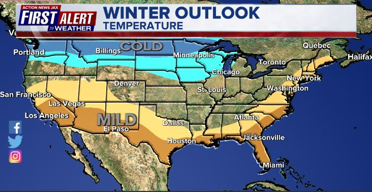
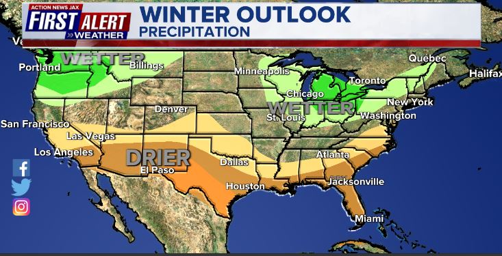
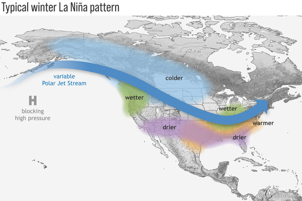
NOAA has issued their winter outlook. The forecast is strongly predicated on the continuing La Nina so cold & snowy across the north, mild & dry across the south. A 3rd year in a row La Nina is rare + I feel the ENSO patterns are less reliable/predictable prior to the warm oceans of this era, so I’m not sure this winter will follow a typical La Nina pattern but time will tell. In any case... the Dec./Jan./Feb. outlook for Jacksonville/NE Fl./SE Ga. is above avg. temps. & below avg. precip.
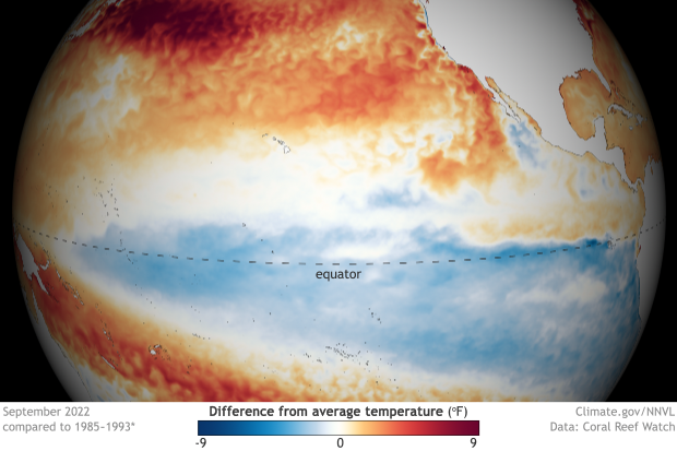
As for the La Nina, it’s still going strong. Note the blue below near & south of the equator across the Pacific:
Forecast models show the La Nina slowly abating late in the ‘23 spring into the following summer (forecast models have a notoriously difficult with long range ENSO predictions):

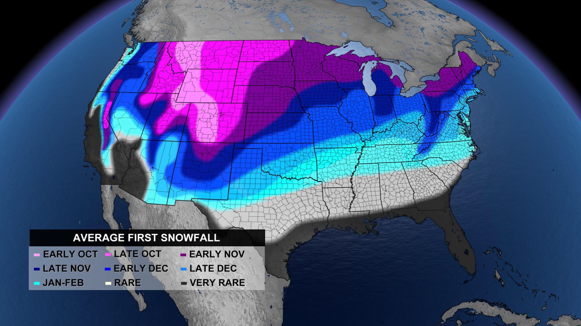
As we head through the heart of autumn with winter fast approaching, the map below shows the average date of the first snowfall across the Lower 48:
©2022 Cox Media Group
:quality(70)/d1hfln2sfez66z.cloudfront.net/04-19-2024/t_744a0fe392b04fa194c322a11f1cea0c_name_file_960x540_1200_v3_1_.jpg)
:quality(70)/cloudfront-us-east-1.images.arcpublishing.com/cmg/N7YMXJTJYJEFBCXSUI6KPLO7OM.png)
:quality(70)/cloudfront-us-east-1.images.arcpublishing.com/cmg/UBK5OW6GKNESZPPDL26F4NQT7U.jpg)
:quality(70)/d1hfln2sfez66z.cloudfront.net/04-20-2024/t_27c4ee35a0bd498ab102ed62d7b8a798_name_file_960x540_1200_v3_1_.jpg)
:quality(70)/d1hfln2sfez66z.cloudfront.net/01-10-2020/t_ee4b940c3a814bbfa5a63a4d4a07481c_name_8EB868847B8846BB9AD5861BCBF666CE.jpg)